- Public access to the structure risk assessments is no longer available. This has no affect on the existing assessments or the collection of assessments by users logged into SAM.
- Collectors can now 'auto-fill' the current address, city and owner name into the assessment from the state parcel data when editing in the web application (not available in the Field Tool). Here is how:
- Go to the Risk workspace
- Make sure the Edit Structure Assessment layer is on.
- Pan/zoom to the area of interest on the map
- You will notice that the state parcel layer is visible by default rather than the outdated risk parcels (removed).
- Open the assessment form. Click on an assessment, or alternatively, add a new assessment by using the Add (Pencil) tool and click on the map.
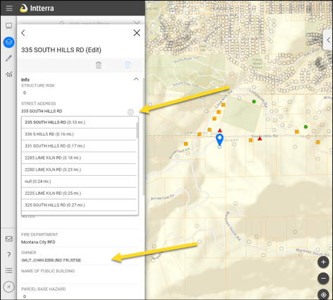
- You will now see a globe icon next to the street address to indicate than an auto-fill is available. Clicking anywhere in that address box will open a dropdown list of nearby addresses (within 1,000 meters) from the state parcel layer - sorted nearest to furthest. Selecting the correct address will add or update the address, city, and owner name from the parcel data.
Additional enhancements are being explored. For more information, contact Julia Berkey Julia.Berkey@mt.gov.