Search Layers in Intterra gives you the power to locate information from your system by entering a search term for a specific item that you expect to find in a given data layer. All results are listed in the tool and highlighted on the map. Specific results can be toggled off and on and the map will zoom to the extent of all the 'on' results. You can view the results of the map by either features or a density map (hot spots).
Here are a few examples:
- Search a parcels layer for an owner or land use classification.
- Search the Active Resources (NWCG) layer to find the location of a specific IHC crew name or all the helicopters.
- Search the Damage Assessment layer to find all assessments collected by a specific user.
- Search the Structure Preplans layer to find a preplan for a specific address.
Step 1: Get Ready
- Make sure the layer is visible in your active workspace.
- Click on Manage Layers.
- Make sure the layer is turn on in the view.
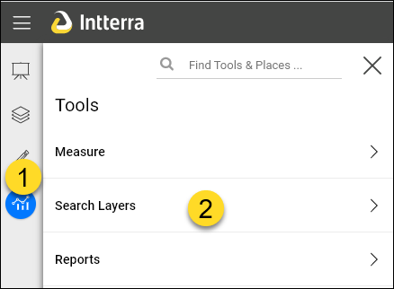
Step 2: Open the Tool
- Click on Tools Menu.
- Select Search Layers.
Step 3: Search
- Enter the search text.
- Select the Service to search (from the layer in the layers menu).
- (Optional) Click on Refine By Layer and then Select the layer from the list.
- (Optional) Click on Refine By Field and then Select the field from the list.
- Click on Search.
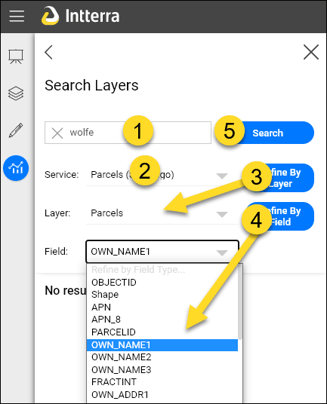
NOTE: Use the optional refine steps (3 ands 4) when searching large dataset.
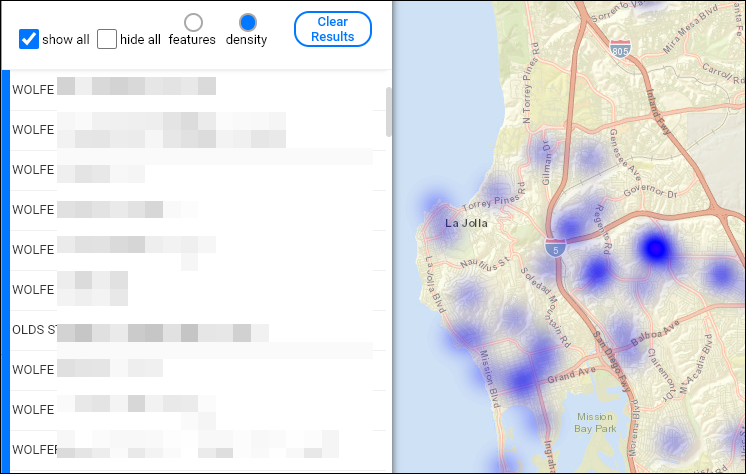
Step 4: View Results
- View results in the list.
- These can be toggled on or off individually.
- View the map. It is interactive and will update and zoom to the extent of results.
- Optionally, choose to view the map as a density hot spot.