When users need to determine the number of structures, population, and other information within an evacuation area, flood plain, or any other map layer boundary, they have the option to select it directly. This approach not only saves time but also yields more accurate results compared to manually drawing a lasso area.
- First, open the Stats Tool for the data to run stats on - just like you currently do. Then...
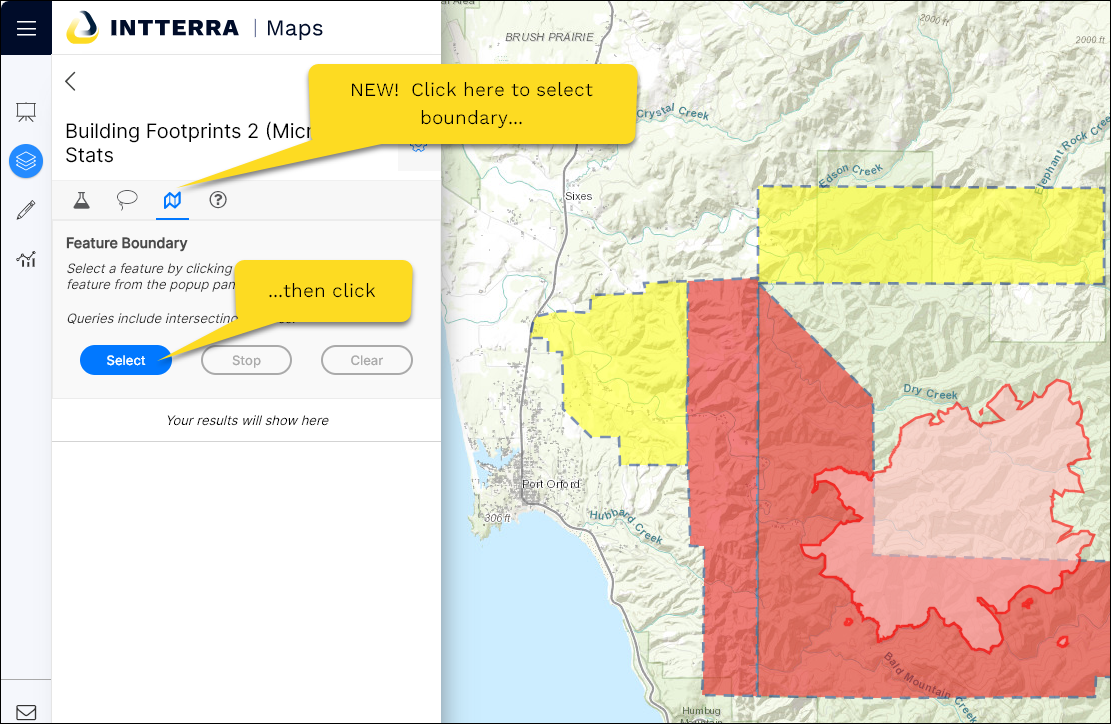
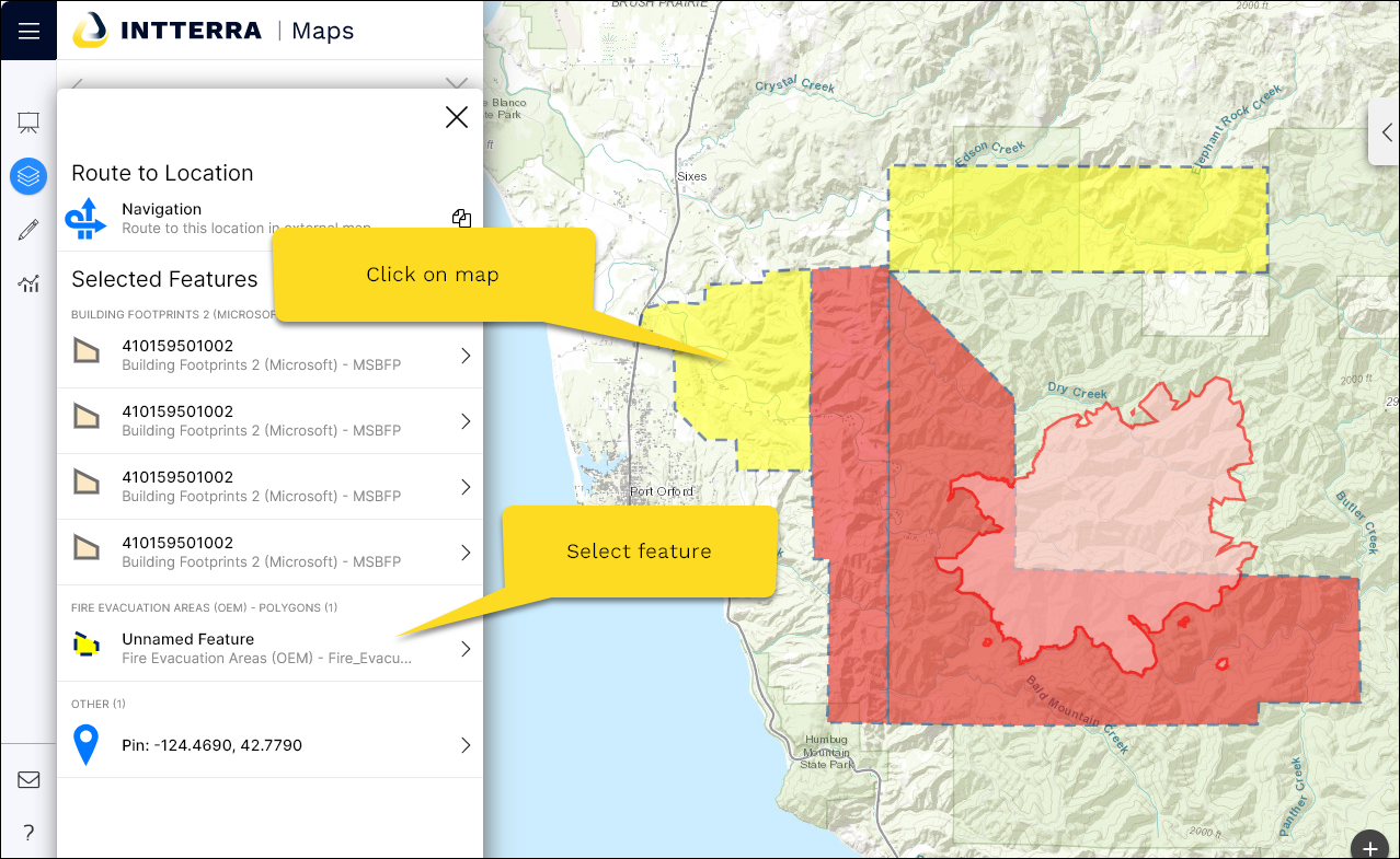
- Select the boundary (polygon) to use an an area to do stats on...
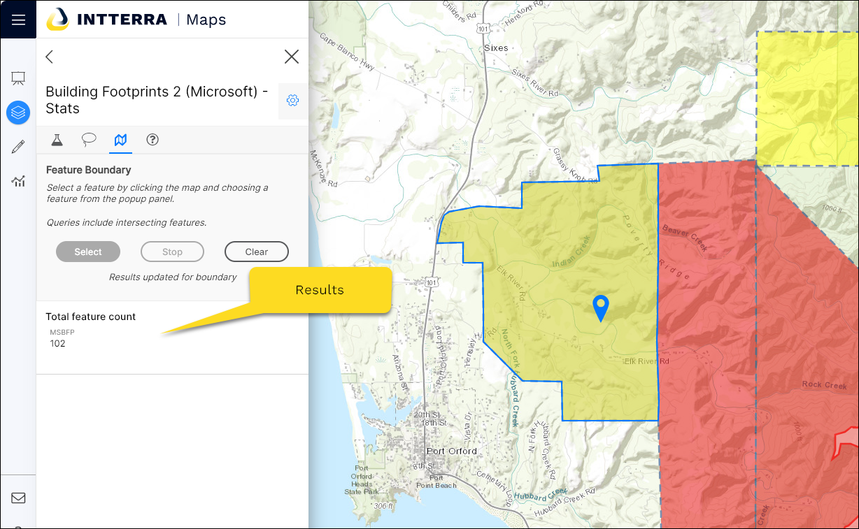
- See the results!
Here are few tips for use:
-
Wait to 'submit' your query until you have defined your area of interest using the lasso or selecting a boundary. Submitting on the define query tab queries the entire area of your screen.
-
When using boundaries to define your area of interest, avoid large or complex features with many vertices.
-
For determining population for larger urban populated areas, consider using the EJScreen layer for the Stats - using sum and select the field that you want. This is not a good option for small query areas or in areas in rural populations.