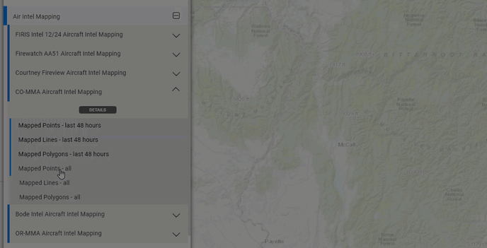
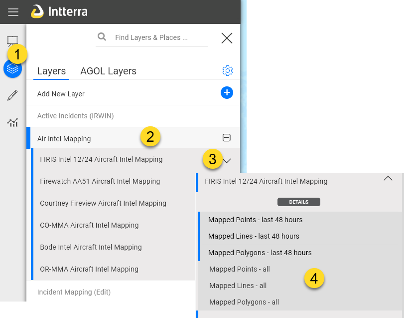
Points lines and polygons from air intel aircraft are loaded into map layers in real time as received by Intterra.
- Users can now view mapping from multiple missions without the need of the air intel tool. Note: The air intel tool is still needed the to view and download imagery and videos.
- By default, users see the last 48 hours of mapping, but can choose to select all mapping.
- Each provider (aka Bucket) has its own layer.
To view
- Click on layers
- Click on the Air Intel layer nest (group) to turn on
- Open access sublayers
- Select what sublayers you want to view. The most recent 48 hours is on by default.
Tips
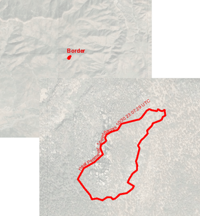
- Perimeters are labeled to provide the mission name when zoomed out and details to distinguish between missions when zoomed far in.
- Individual features can be copied to the incident map by users with incident edit credentials.
Known issues with the airborne ETL process that we are looking into -
- Some perimeter polygons are not being converted.
-
- Firewatch AA51 perimeters that show both previous perimeter and new growth.
- Some Courtney Fireview fire perimeters don't process.
- We are using the mission name provided by the aircraft to label products on the map. This is creating some interesting combinations of labels for a single incident.