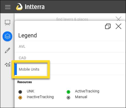
Mobile Resources are displayed based on tracking type - Active Tracking, Inactive Tracking, and Manual (and Unknown). One of the primary uses of the Mobile Resources Tool is for assigning a Resource Label to display on the map.
The Tool
The Mobile Resources Tool provides users with the ability to:
- View and export all of the units and associated information in an Interactive Table. It's easy to sort and filter so that you can view by your agency, home unit, or distance from the center of the map.
- Add units manually. These will not be tracked, but may work for showing a static resource on the map.
- Edit units, which is especially important for checking in resources and assigning a Resource Label.
The Mobile Resources Tool is accessed from the Tools Menu icon, typically from the Operations or Plans Workspaces. NOTE: If you don't see any units after accessing the Mobile Resources Tool, ensure the Mobile Units Layer is turned on (has a blue line on the left side) in Manage Layers.
See Interactive Tables for help on using the table's tools.
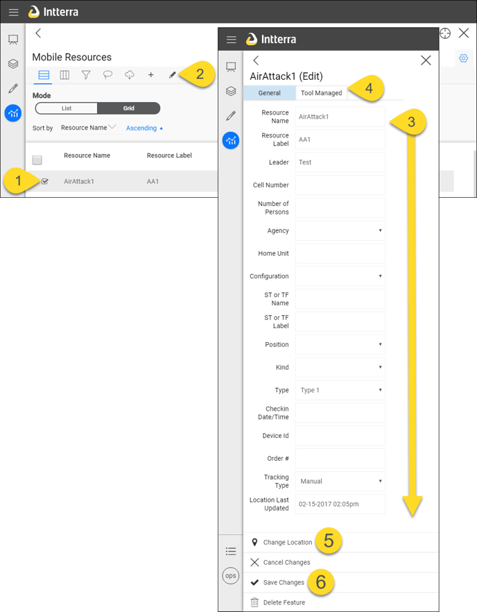
To Edit
- Click on a resource to edit.
- Click on Edit. This opens an edit pane.
- Edit text. Be sure to complete the Label field. TIP: Keep it short.
- Optional: Edit incident assignment information in the Tool Managed tab.
- Optional: Change Location. This is primarily for Manual tracked resources. You can also edit the location by dragging on the map.
- Save Changes.