An important feature of the Field Tool is the capability to view and collect the information while offline and then have that information sync to Intterra when connectivity is adequate. There is no need to copy and manage files to or from a cloud storage folder. However, users can sometimes be confused by what they don't see and how data automatically comes and goes from the map as they change location.
This article is intended to provide an overview and visual comparison of the two ways data is cached (loaded) to a device as local storage so that its available when in no/poor comms. Click on the links for details.
- Auto-Cache - Automatically loads data in your 'vicinity' to your device on a scheduled basis.
- Offline Areas - Manually loads data for one or more user-defined Offline Areas.
Note: For both methods, added and/or edited data is synced back and shared to other users when a the feature is saved and internet connectivity exits and Force Offline is off.
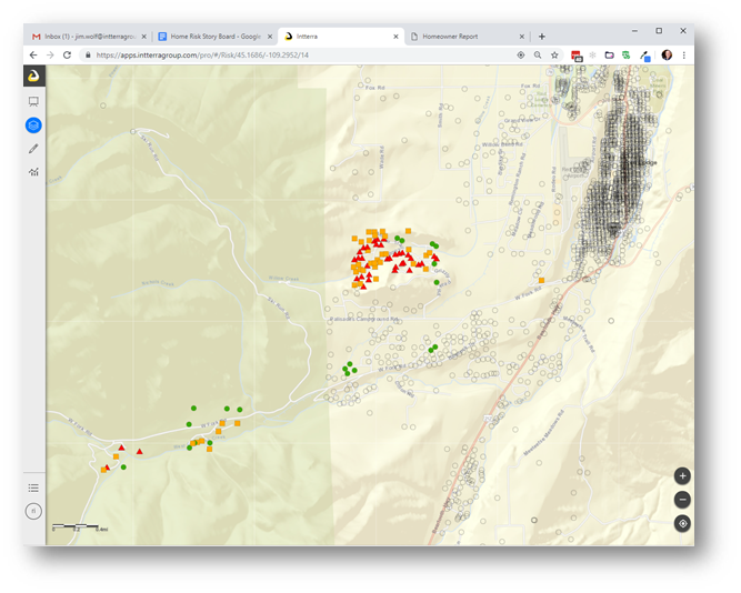
When using the browser-based Maps app, the latest data is available for the full screen extent.
 By contrast, only data that is auto-cached for the vicinity of my location or added manually for an offline area is visible.
 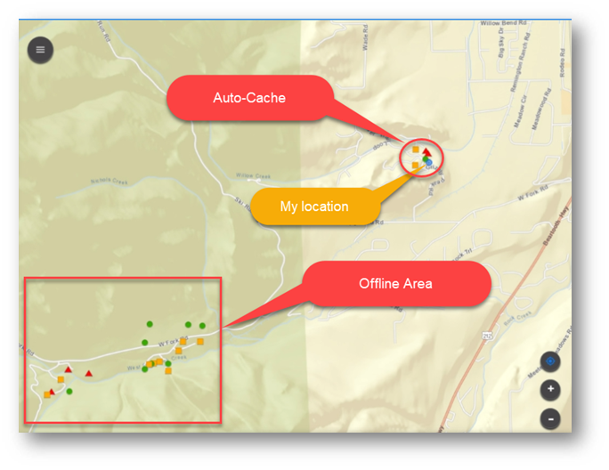 When I move to a new location, auto-caching will automatically add new near-by data and remove data no longer in the vicinity based on the update settings. There are no changes to the offline area.