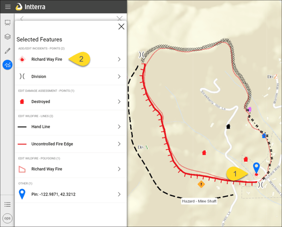
The Info Panel has tabs that contain detailed information about an item or location on a user's Intterra map and includes route to location.
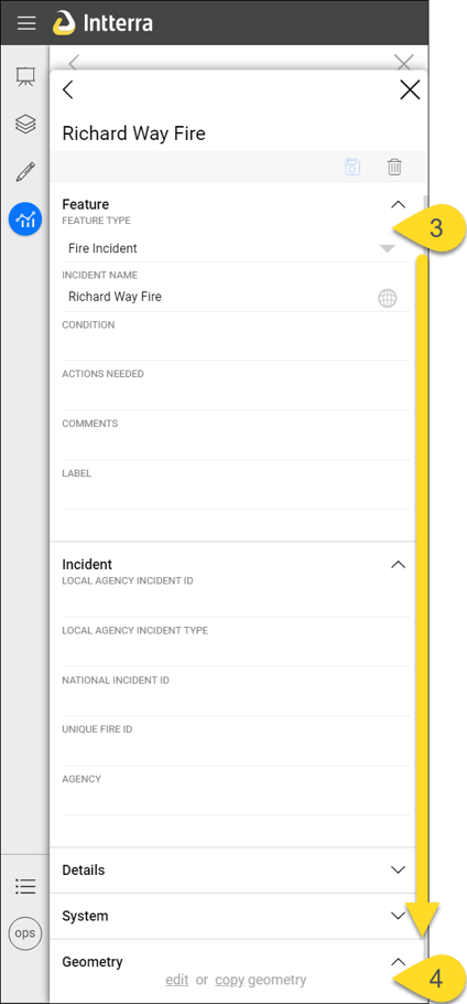
This is also where users will be able to edit (and delete), as well as copy (which allows you to copy the feature to another layer in Intterra) a feature.
- Click on a feature that is on the map, such as fire perimeter or line.
- From the proximity results listed within the Info Panel, choose the feature title most closely resembling the feature you intended to select.
- Look through the details that have already been recorded about the map feature you selected (such as Fire Name, Comments, Agency, and Unique Fire ID) or automatically generated (such as who it was Created By, the date and time that it was last modified, and the Acres measurement within any perimeter feature) when the feature was added or updated.
- Depending on the permissions your department Project Manager has assigned you, you may also be able to edit (including delete) if it is part of your organization's working map (stored as a geodatabase). If the feature is not already part of your organization's working map (added by someone in your organization), you may want to copy to your organization's geodatabase.


NOTE: Feature details vary from feature type to feature type. For example, the feature Spot Fire has additional fields such as Point Name, Label, Capture Time, Contact, Phone.
NOTE: Any additional map layers, as well as the GPS coordinates for the point  you selected, will also be listed. The item being displayed in the info pane is indicated by the short blue stripe at the left edge of the info pane.
 you selected, will also be listed. The item being displayed in the info pane is indicated by the short blue stripe at the left edge of the info pane.