If you are in the field and don't see the features or icons you are used to seeing, try the following four options (in order) to troubleshoot:
- Within the Field Tool, turn the layer you are using off, and then back on. (This may take a little time because of all of the data points, so please be patient.)
- View > Your current layer (should have a blue line to the right, indicating it is on).
- Tap the blue line so that it goes away, give it a little bit of time, then reselect it to turn it back on. (When the layer is off, there will be no blue line.)
- Close the Field Tool (but do not log out). Re-open the app.
- Log out of the Field Tool, and then log back in.
- Delete the Field Tool and then reinstall it.
A bit more background:
If you have good comms, we recommend you stick with using the web version of Intterra in the field. If comms are poor, however, one benefit of having the Field Tool is that it's designed to work where there is no internet service. To accomplish that, the app needs to download and cache your data on the device so that it is available to view and edit when out of comms. There are limits to how much data your device can store and utilize effectively, and loading data to your device takes time and responsiveness away from your ability to view and edit. For this reason, the app only auto-caches the data that is closest to your current location.
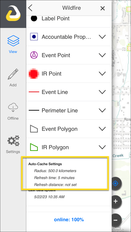
Since not all the layers have the same density and complexity, the distance (radius) varies by layer. To see auto-cache settings, tap on the layer name's down arrow, and then look to the end of the layer list.
For additional information about the Field Tool:
- Getting Started with the Field Tool
- Sharing Your Location Reference for the Field Tool
- Field Tool Offline Areas
- Field Tool Auto-Cache